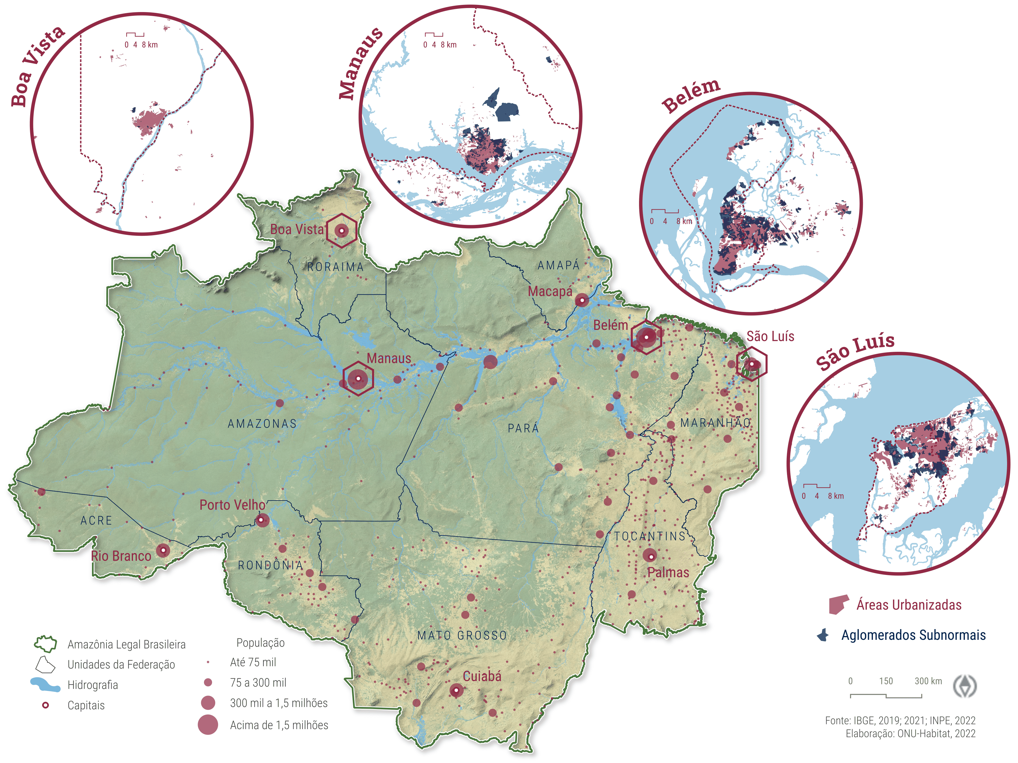
Slums and urban informal settlements in Amazonian cities
By Gabriel Vaz de Melo
December 8, 2022
Map created using QGIS, representing slums and urban informal settlements in four Amazonian cities. Spatial data utilized were obtained from the Brazilian Institute of Geography and Statistics (IBGE), specifically from the Favelas e Comunidades Urbanas dataset provided by the 2022 Demographic Census.

This dataset identifies urban areas characterized by irregular land tenure, inadequate housing infrastructure, and limited access to essential public services. The visualization highlights socio-spatial inequalities and aims to inform targeted urban policy interventions and sustainable development planning efforts in the Amazon region.
- Posted on:
- December 8, 2022
- Length:
- 1 minute read, 84 words