Population and territory in the Amazonian Tri-border region
By Gabriel Vaz de Melo
September 3, 2023
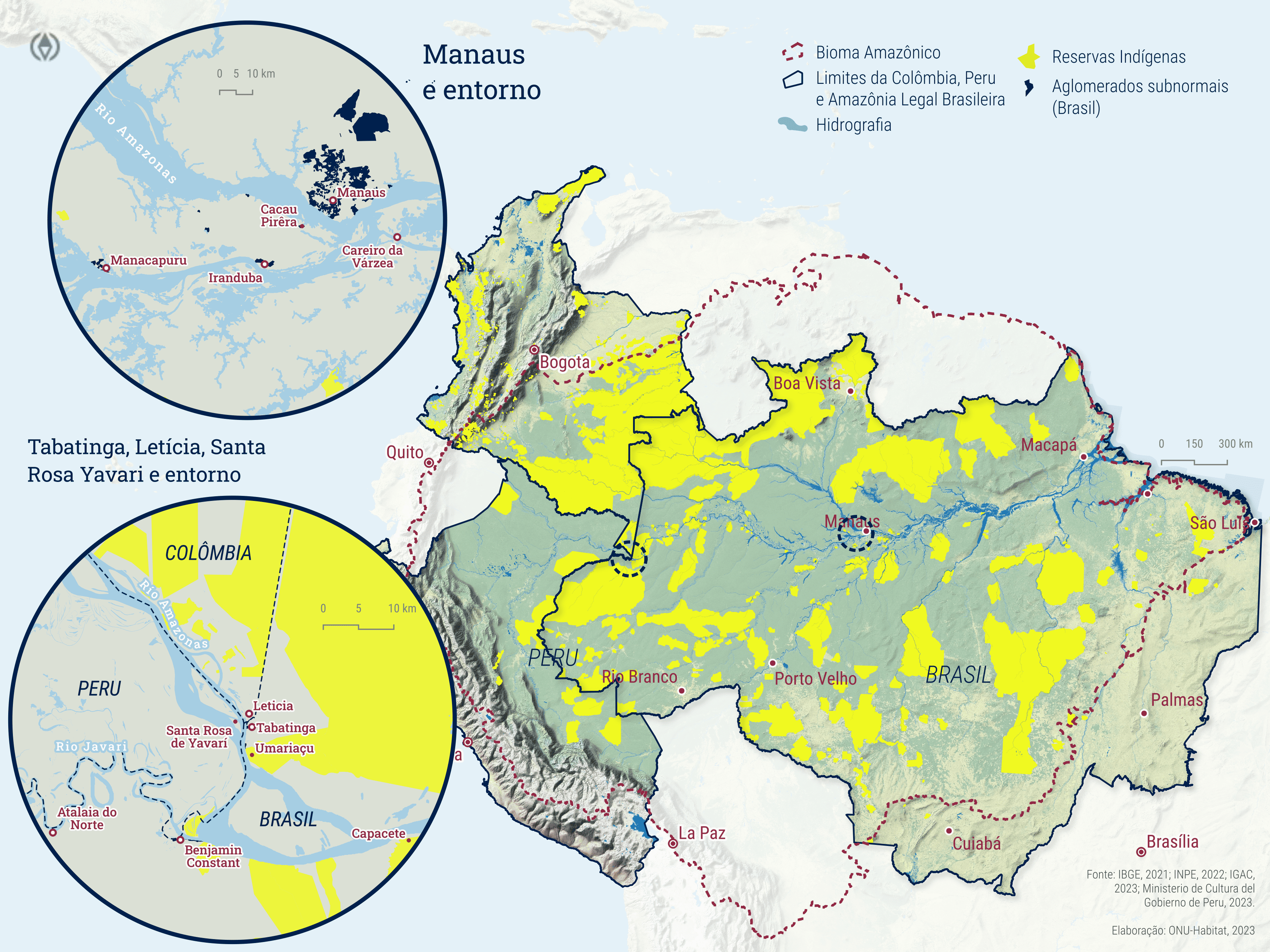
Maps created using QGIS for UN-Habitat Brazil, representing population distribution, Indigenous territories, slums, and urban informal settlements in the Amazonian Tri-border region

Figure 1: Indigenous Territories within the Brazilian Legal Amazon, Colombia, and Peru, as well as informal settlements and urban communities in Manaus and its metropolitan region
For the next map, population data were sourced from the WorldPop project, and building data were obtained from Google Open Buildings.

Figure 2: Population distribution in the tri-border area of Brazil (Tabatinga), Colombia (Leticia), and Peru (Yavarí).
- Posted on:
- September 3, 2023
- Length:
- 1 minute read, 85 words